
Checking the rules
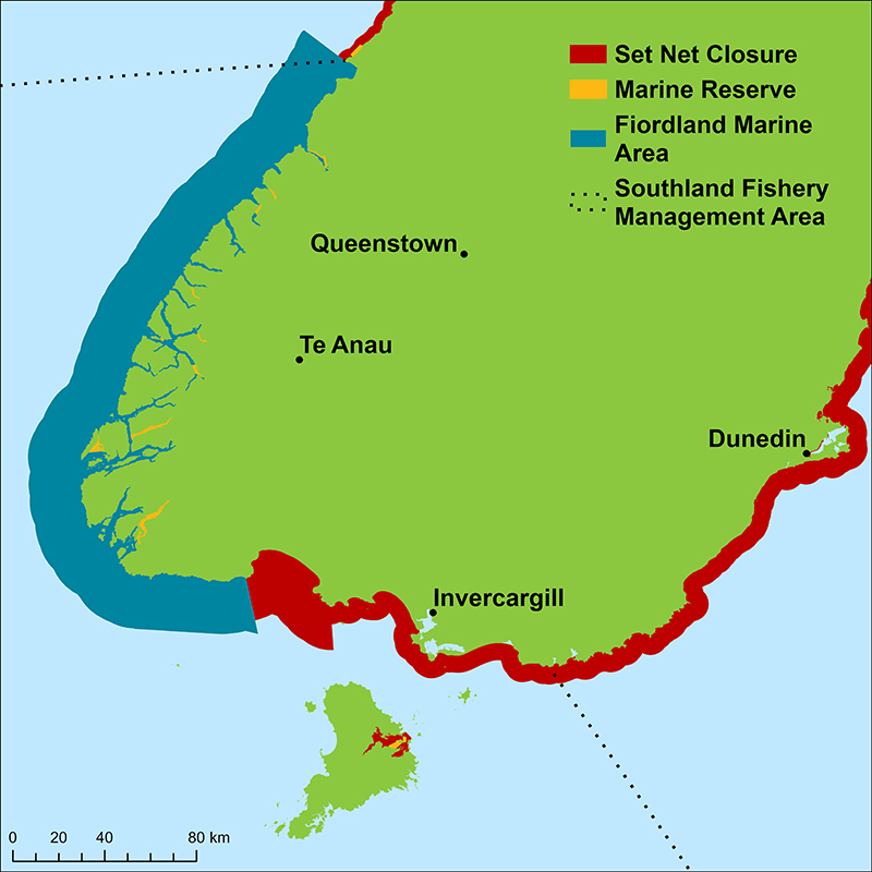
The Southland Fishery Management Area covers:
- the waters south and west from Awarua Point (South Westland) to Slope Point (the Catlins south-east coast)
- Foveaux Strait, Stewart Island, and all adjacent islands and waters out to 200 nautical miles.
Note that separate fishing rules apply to Paterson Inlet (Stewart Island) and the area does not include Fiordland, which also has different rules.
A more detailed map is on the NZ Fishing Rules app. We recommend using the app to check size limits, catch limits, closed areas, and other restrictions wherever you're fishing.
The app is free and available for both Apple and Android devices.
You can also keep scrolling on this page to see the rules.